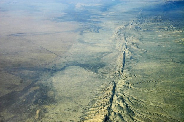
Aerial view of San Andreas Fault in the Carrizo Plain, 8,500 ft. altitude. (Photo : Ikluft/Wikimedia/UH)
Could California face a massive earthquake soon? New GPS data analysis of the state's most volatile fault line, measuring at 800 miles long, reveals how there are new regions that registered movement, described as a swinging up and down motion, as this fault line extends north of Eureka all the way to Baja, California.
In this new study, scientists have identified some "lobes" measuring 125 miles wide of this uplift and subsidence along the San Andreas as observations show a few millimeters of movement every year.
Now, researchers from the University of Hawaii in Manoa collected data from the EarthScope Plate Boundary Observatory's GPS and conducted an analysis that confirmed the movement of the crust in the region, as been predicted by past studies and computer models.
According to lead author of the study, Samuel Howell from the University of Hawaii, for more than 10 years the San Andreas GPS data has been available to the public, however, the vertical properties of these measurement have been mostly overlooked by tectonic investigations due to challenging interpretations of noisy data. By using this new method, noisy signals were broken down by isolating the vertical motion pattern that is overwhelming the San Andreas fault every year.
These new findings can help researchers and future studies about the importance of GPS vertical motion measurements for the better understanding and even better predictions of the San Andreas fault line and others as well, even those fault lines that do not possess any ruptures for decades or even hundreds of years.
This new study is published in the journal Nature Geosciences.


