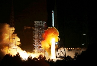
The Chinese government has started operation of Gaofen-2, the country’s most advanced observation satellite, on March 6, Friday.
Xu Dazhe, head of the State Administration of Science, Technology and Industry for National Defense, said that Gaofen-2's services are expected to enhance the development of the country's data gathering and application as well as its spatial information sectors.
The Gaofen-2 is the second in the series of seven satellites, which is part of Gaofen, the country's high definition (HD) observation project that will be launched before 2020. The project was started in May 2010, but Gaofen-1 was not launched until April 2013.
The Gaofen satellites, managed by China National Space Administration based in Beijing, are all expected to provide weather information with 24-hour service that covers the world.
Authorities added that the satellite will also provide NRT (Near-Real-Time) observations for disaster prevention and relief, climate change monitoring, geographical mapping, environment and resource surveying, as well as for precision agriculture support.
The observation data will be used mainly by the Ministry of Land and Resources, Ministry of Environmental Protection, and the Ministry of Agriculture.
The Global Times reported that the Gaofen-2 can see 0.8-meter-long objects from space in full color and collect wide-spectrum images of objects 3.2 meters or longer.
The report said that Gaofen-2 released its first photos in late September. In one of the photos, one can clearly see a pedestrian crossing in the Xizhimen area in downtown Beijing.
More than 10 Chinese government departments, including the ministries of land and resources and transport, will benefit from the Gaofen-2 services, authorities said. These also include support for non-governmental organizations and private enterprises for value-added services.


