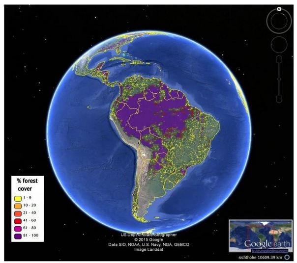
New hybrid forest map is more accurate than existing maps both for forest location and estimation of percentage forest cover. (Photo : IIASA Geo-Wiki Program)
"Citizen scientists" from around the world collaborated on the internet to help create very accurate maps of global forest cover that will provide the clearest picture yet of the extent of forest cover, the depth of deforestation and the effects of climate change on global forests.
The new maps were developed by a Geo-Wiki team for the International Institute for Applied System Analysis (IIASA) and provide a most accurate view of global forests.
The maps are freely available for exploration and download on the Geo-Wiki Web site (http://www.geo-wiki.org/). They were published in the journal Remote Sensing of the Environment.
The maps' creators said knowing the location and extent of forests is crucial information for ecology, climate change and economic modeling. These maps will also be invaluable for researchers looking for the best reference information to estimate deforestation and forest degradation.
The new maps will be useful for research and for policymakers that rely on forest data for planning and decision making purposes. They complement another set of global cropland and land cover maps from the Geo-Wiki team and network published earlier this year.
Dmitry Schepaschenko, lead author of the study, said the new maps rely on a combination of recent multisensory remote sensing data, statistics and crowdsourcing,
"By combining different data sources, and incorporating the input of trained citizen scientists, we were able to produce new maps that are more accurate than any existing data source", he noted.
The study introduces two global forest maps, both at one kilometer resolution. These maps provide a good compromise between the level of detail and global coverage.
The first, which researchers refer to as a "best-guess" map, uses eight different data sources and relied on a network of citizen scientists to check or validate the classification of land cover, by looking at high-resolution satellite imagery of different locations.
Compared to existing maps, this new hybrid map is more accurate both for forest location and estimation of percentage forest cover.
"These new maps just go to show that regular people, in their free time, can contribute to top quality research," said Schepaschenko.
"Geo-Wiki and our network of volunteers continue to help us improve land cover and develop robust products for the modelling and policy communities," said IIASA researcher and study co-author Linda See.
The second map was calibrated using regional and country-level forest statistics from the Food and Agriculture Organization (FAO). This data made the map more useful for economic modeling. This is also the first forest map consistent with FAO statistics and is freely available.
A comparison of the "best guess" and calibrated maps highlights the countries where there are discrepancies and raises questions about reporting.
The new maps were produced for the year 2000 as a base year for modeling. The team also plans to update them with data for 2010 in the near future.


