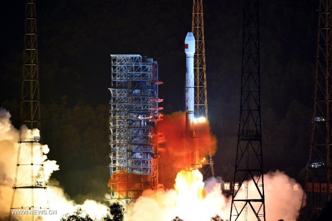
A Long March-3B/Yuanzheng-1 rocket carrying two satellites for the Beidou Navigation Satellite System (BDS) blasts off from the Xichang Satellite Launch Center, Sichuan Province, July 25, 2015. (Photo : Xinhua)
After more than 10 days in space, China’s 19th Beidou navigation satellite is now working autonomously and has established a link with another satellite.
The two satellites were both launched on July 25 by a Long March III-B rocket from the Xichang Satellite Launch Center in southwest China's Sichuan Province, according to a report from the Xinhua News Agency.
Xie Jun, chief designer of the Beidou Navigation Satellite System (BDS), said that tests of the autonomous control technology in the Beidou satellite constellation, an alternative to the Global Positioning System (GPS) operated by the U.S., has been successful and marks a solid step toward building a system with global coverage.
China plans to establish a complete constellation of 35 satellites and achieve global coverage by 2020.
The "twin sats" surpassed their predecessors in speed, accuracy and weight, the report said.
"The biggest difficulty is the autonomous navigation technology," Xie said. "We need it to maintain the sustainable development of the project."
Wang Ping, a chief engineer on the project, said that the inter-satellite link enables the satellites to communicate and measure distances with each other, bringing autonomous control of the navigation system a step closer.
Autonomous navigation is the key to the global operation of the project, as it allows the satellites to work independently and provide users with more accurate data.
Named after the Chinese term for the Big Dipper constellation, the Beidou satellite project was officially launched in 1994, around 20 years after GPS was introduced. The first Beidou satellite was launched in 2000.
By 2012, a regional network had taken shape and was providing position, navigation, timing and short message services to users in China and other Asian countries.
BDS is one of the world's four main navigation systems, along with GPS, GLONASS from Russia, and the European Union's Galileo. All four make use of autonomous navigation technology.


