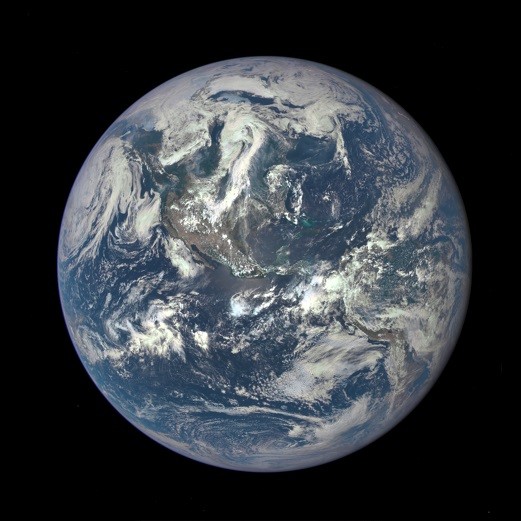
A new, spectacular image of the entire planet Earth was captured by a NASA satellite, where the planet is viewed in its wholeness that is reminiscent to the "Blue Marble" photo of the planet that was taken during the Apollo 17 lunar mission.
This amazing Earth photograph was captured July 6, presenting Northern and Central America.
The photo from the Apollo mission was taken at 28,000 miles away where this newest Earth "selfie" was captured from a distance of 1 million miles using NASA's Deep Space Climate Observatory (DSCOVR) satellite's camera and telescope.
This particular composite image was created with 10 images from the Earth Polychromatic Imaging Camera (EPIC) with 4 megapixels of resolution power where every image that was captured was used with separate filters ranging from near infrared and ultraviolet frequencies.
NASA also explains that this filter range is necessary to produce a variety of images for further scientific study. The space agency also adds that this newest Earth color photo only required the red, blue and green channel image.
According to project scientist Adam Szabo of DSCOVR, these high quality images that were produced by the EPIC camera exceeded all expectations when it comes to resolution. Even from a million miles, the images clearly reveal the planet's geological features such as desert sand structures and river systems including cloud systems. This is truly a wealth of new data for more scientific exploration, he adds.
DSCOVR's main mission is to track solar winds to gain more data about space weather forecasts particularly electromagnetic solar storms that constantly hit Earth that can disrupt satellite communications and power grids. The DSCOVR mission is also a joint project by NASA, the U.S. Air Force and NOAA (National Oceanic and Atmospheric Administration).
The DSCOVR satellite was launched February this year where it has finally reached its destination point of 1 million miles from Earth, earlier this June. It is now orbiting at a Lagrange point or L1 in astronomical terms where Earth's gravitational forces along with the sun is balanced, keeping a steady location for the satellite between the two bodies.
These images are pivotal in the monitoring of ozone and pollution levels in the Earth's atmosphere which also provides data regarding cloud height and vegetation properties, says NASA. Apart from its data gathering and space weather monitoring, the satellite will document and capture photos of Earth every day for the duration of its mission.


