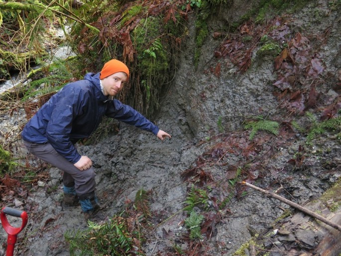
UW graduate student Sean LaHusen pointing to buried debris at an older slide on the north fork of the Stillaguamish River. (Photo : Alison Duvall/University of Washington)
Last March 2014, a landslide devastated Oso, Washington where this massive impact became a mystery to geologists. Now, a new study reveals that landslides in Oso will not stop due to the origins of its geological terrain.
Researchers from the University of Washington revealed in a new study that over the past 2,000 years, the same area located in Stillaguamish River's North Fork apparently suffered from a big slide with an average of one slide for every 140 years.
According to lead author of the study Sean LaHusen from the University of Washington, this is due to the very dynamic landscape of the region, where it is also very unlikely that landslides will stop from occurring in this valley.
The devastation left by the valley last year killed 43 people where scientists and researchers conducted this new study to investigate the region where they used laser scanning techniques called lidar to map out the area. This method can clear away vegetation from view, that can trace back evidence of past landslides in the valley.
The team of scientists collected soil deposits from these past landslides that were submerged in the river banks, where they also hiked nearby slopes to locate trees or wood remnants from the underslide, all of which are radiocarbon dated.
However, just downstream near the Oso landslide site, a huge slide known as the Rowan slide which is measured to be twice as large as the one in Oso, sent material skidding spanning the entire valley, similar to the Oso slide. Researchers dated the materials and discovered that the Rowan slide occurred some 500 years ago.
LaHusen and team now believes that the Oso slide cannot be dismissed as an outlier since in geological time, the Rowan slide is relatively recent, adding to the team's knowledge of the dates of the prior slides in the region.
This new study also revealed how glaciers in the region retreated some 15,000 years ago, where the river valley became prone to landslides. When the glaciers passed, they left a rubble of till, clay, sand and lake sediments, making this a very unstable, porous mix that produces landslides.
This new study is published in the journal, Geology.


